The Oxford to Cambridge Arc 4
|
 The hamlet of Sherington Bridge is on the north side of the bridge right on the border of the parish on the road towards Newport Pagnell. It is not known when the first bridge was built, but one of the first known references to the bridge is in the 13th century. It is thought that the original construction of the bridge had a stone or rubble base and a wooden upperpart. The bridge has been replaced a number of times since then, the most recent being in the early 1970's with a concrete construction. The picture above shows the previous bridge with the pedestrian passing places between the arches. ( From http://www.mkheritage.co.uk/shhs/tour11.htm )
The Oxford to Cambridge Arc
Newport Pagnell to Bedford
After Newport Pagnell, all routes headed to Bedford and, given the importance of Newport Pagnell and Bromham as crossing points over the winding River Great Ouse, it is highly likely that the maker of the Gough Map passed this same way too.
Ogilby’s 1675 route
Newport Pagnell has been a critical crossing point of the River Great Ouse right up until the motorway era, both for West-East and North-South routes, hence the fortification of the riverside town by Parliamentarian forces only 24 years before Ogilby completed his Britannia Atlas. It was certainly essential to the Oxford to Cambridge route.
 Extracted from John Ogilby's Britannia, 1675 Extracted from John Ogilby's Britannia, 1675
 Extracted from John Ogilby's Britannia, 1675 Extracted from John Ogilby's Britannia, 1675
From Newport Pagnell Ogilby noted two stone bridges before reaching Chichley. These are Lathbury Bridge (a little north of the North Bridge in Newport Pagnell itself on the current B526) and Sherrington Bridge on the currently unclassified Sherrington Road.
After Chichley, Ogilby’s route passed along the current A422, though keeping to the roads through Astwood and Stagsden which were only by-passed as recently as the early 1990s.
Ogilby passed straight on into Bromham, to cross the Owse Flu (River Great Ouse) via the old Bromham Bridge. Today’s bridge has 26 arches and looks at first glance to be of medieval origin. It is, however, largely a product of the rebuilding of 1813, though a bridge has existed on the site since the early Middle Ages.

Between Bromham and Bedford Ogilby notes Fordend House as a landmark to the right of the road into Bedford. At least two hundred years old when Ogilby passed by, the Bedfordshire Historic Environment Record notes that the house was demolished around 1960.
Ford End Manor House about 1910
© John Dunn.
|
|
|
|
|
 The Oxford to Cambridge Arc
John Cary's route from his 1815 New Itinerary
Newport Pagnell to Bedford
 
This is a strange route. Despite the Bedford and Newport Pagnell Turnpike being one of the earliest available, from 1754, Cary followed a less direct route.
Hetravelled northwards out of Newport Pagnell on the Kettering and Newport Pagnell Turnpike, also completed in 1754, passing through Sherrington and Emberton to Olney.
From Olney, he left the turnpike to travel westwards through Clifton Reynes, Newton Blossomville and Cold Brayfield to Turvey.
Thissurprised me, as the route taken from north of the church in Olney to Clifton Reynes today consists of little used muddy footpaths and flimsy foot bridges over the River Great Ouse. Also, today no one passes through Clifton Reynes as the village is at one end of a cul-de-sac.
What’s more, there was a turnpike in existence from 1790 which connected Olney to Bromham, via Lavendon and Cold Brayfield.
However, it could be that in the early days of the Olney to Bromham Turnpike,the route actually went through Clifton Reynes and Newton Blossomville.Further research is needed, but I have found possible evidence for thistheory from The History and Antiquities of the County of Buckingham, Volume 4, by George Lipscomb, p.257, published in 1847.

Thisdeparture from the turnpike can be better understood if one consults Cary’s own map of the area from 1801. He marked the Olney to Cole Brayfield (Cold Brayfield) road as a route of some significance. Note that in Olney the road starts from just north of the church, crosses theGreat Ouse and runs the length of Clifton Reynes on the way to Newton Blossomville and Cole Brayfield. Today, at the Olney end of this route and at Cole Brayfield, only footpaths and bridleways and footbridges mark the route.

Sectionof Cary’s 1801 map of Buckinghamshire showing the route from Olney to Cole Brayfield (Cold Brayfield) through Clifton Reynes.
Comparethis with an earlier 1787 map by Cary which has the Ogilby route to Bedford as the turnpike to follow, i.e. through Chichley, Astwood and Stagsden. This route is no longer highlighted on the 1801 map.

Section of Cary’s 1787 map of Buckinghamshire showing the Newport Pagnell to Bedford route which matched that of Ogilby.
The downgrading of the Ogilby route is better understood in the light of the following contemporary account:

Rev. Daniel Lysons and Samuel Lysons, Magna Britannia, Vol 1, 1813, p.23
The Ogilby route, whilst still nominally the Bedford to Newport Pagnell Turnpike (1754)was, by 1813, considered to be the ‘old road’ which had fallen into disuse. This was written only two years before the 1815 edition of Cary’s Itinerary.
TheSherington History website also notes that ‘the Bedford to Newport Pagnell Turnpike ran into financial difficulties, and by 1770 its operations had been suspended’. A new turnpike trust was not establishedto maintain the road until 1814, too late to have any meaningful impacton road conditions and be worthy of inclusion in Cary’s 1815 Itinerary.
Having reached Cole Brayfield, Cary’s route followed the Olney to Bromham Turnpike, and from Bromham resumed the Ogilby route into Bedford.
© John Dunn.
|
|
 Supplement to Cary's Newport Pagnell to Bedford route
Pictured left: Toll House as it stands today, Newport Pagnell North Bridge
Oxford to Cambridge project
This bridge is a single span stone bridge, which allowed horse-drawn vehicles to pass in and out of town. Originally there was a ford at this point, and then later a timber bridge stood alongside the ford. This wooden bridge was rebuilt in stone around 1380 and was made up of three arches. It survived until 1810, when the present North Bridge was built.A single arch of the 14th century bridge can still be seen in Ousebank Gardens.
In the process of putting together the planning for the building of the present bridge authority was given to build a toll house with gates near the bridge to take tolls from anyone wishing to cross with vehicles or animals. The money raised was to pay costs incurred by the bridge. There was initially a temporary building. The present bridge was completed in1809 and carries this date on the keystone of the arch on its west face. The present toll house wasbuilt. The bridge has undergone repairs since. In 1837 gas was used for lighting on the bridge instead of oil thanks to a gas works in the town. The front bay window of the toll house was used as a lookout so that no potential toll collection was missed. ( http://www.mkheritage.org.uk/nphs/the-north-bridge-built-1810/ )
Toll House North Bridge late 19th early 20th C.
Cary left Newport Pagnell, travelling briefly on the Northampton to Newport Pagnell Turnpike. The first toll to pay was at the North Bridge over the River Great Ouse. The toll house still stands.
 Grid ref on 2020 OS map Grid ref on 2020 OS map
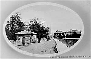
Cary then turned right to join the Kettering and Newport Pagnell Turnpike.The first toll to pay on this turnpike was at Sheringham Bridge. The old toll house had been incorporated into a still extant residential property called Bridge House.
 Grid ref on 2020 OS map Grid ref on 2020 OS map
Still on the Kettering and Newport Pagnell Turnpike, the next turnpike gate was encountered at Emberton.
 Grid ref on 2020 OS map Grid ref on 2020 OS map
After passing through Olney, Clifton Reynes and Newton Blossomville, Cary joined the Bromham and Olney Turnpikeon which the next toll to pay was at the Bromham Gate, just before the edge of Bromham village in 1815, at what is now the west end of the modern village (TL 000 510), some 200 yards west of the junction of Northampton Road with Grange Lane.
 Grid ref on 2020 OS map Grid ref on 2020 OS map
My assessment is that Cary would have joined the Bedford to Newport Pagnell Turnpikein Bromham after this gate. The trust that was reconstituted to run this road did not establish a turnpike gate along Cary’s remaining route into Bedford until 1820. Even the great Bromham Bridge was maintained by the county authorities, so it would seem that the remainder of his journey into Bedford would have been toll free. The condition of the road however would have been particularly bad.
© John Dunn.
|
|
 The Oxford to Cambridge Arc
North Crawley, a village on the Moll 1710 route
Herman Moll's 1710 route
Newport Pagnell to Bedford
Moll's 1710 map has few details between Newport Pagnell and Bedford. However a point of interest is that instead of crossing the River Great Ouse at Newport Pagnell, the route crosses the River Ousel, to pass out of the town from the eastern side. This may have been the road through North Crawley that rejoined the Ogilby route at Astwood. It might well, of course, have been an error due to working on a small scale whole-England map.

Extracted from the 1710 map of England by Herman Moll
A later 1732 map of Buckinghamshire by Moll on a much larger scale shows a nicely replicated version of the Ogilby route.

Extracted from the 1732 map of Buckinghamshire by Herman Moll
© John Dunn.
|
|
|
|